






















Service Hotline
News

News

The “Belt and Road” Beidou Industrial Application Platform Construction Project Achievements Exhibition and Exchange Conference was successfully held in Beijing
2021-12-29
952
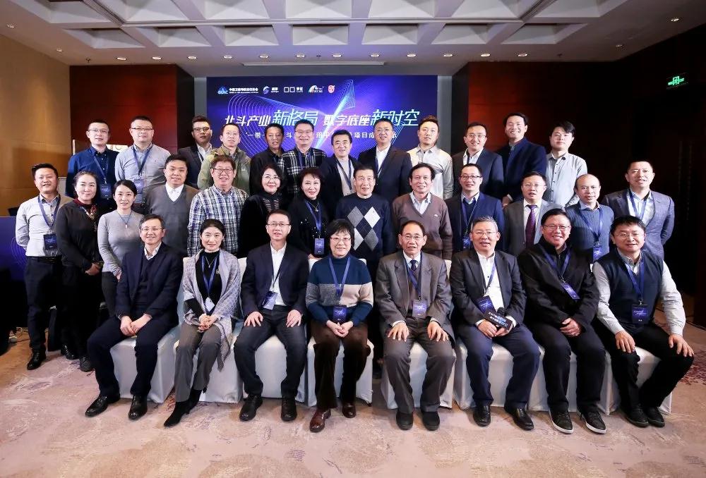
On December 29, 2020, the "One Belt and One Road" Beidou Industrial Application Platform Construction Project Achievements Exhibition and Exchange Meeting, hosted by the China Satellite Navigation and Positioning Association with the theme of "New Beidou Industry Pattern - New Space-Time of Digital Base", was successfully held in Beijing, bringing together relevant leaders, industry experts and industry elites in the Beidou field to participate.
The conference released the "One Belt and One Road" Beidou Industrial Application Platform data engine system - Super Engine All-Time and Space Digital Base, which conducted a full synchronous webcast through the cloud service industry Internet platform.

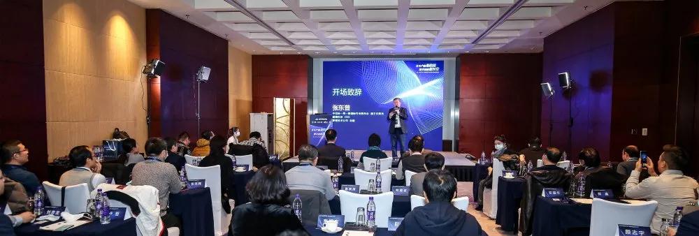
The conference carried out comprehensive and in-depth exchanges around the Beidou service application platform "Super Engine Digital Base", and discussed the ecological service value of the all-time and space digital base based on Beidou's high-precision positioning, high-precision maps, and high-resolution remote sensing. Through the exchange of practical application cases and related solutions, the conference actively explored the value contribution of the Super Engine digital base in empowering smart service fields such as digital city construction, smart city data operations, transportation and municipal administration, and the strategic opportunities for Beidou application services in the "Belt and Road Initiative."
Zhang Dongpu, deputy chairman of the Belt and Road International Professional Committee of the China Association for Economic Cooperation and Development, President of Luokung Technology Company, and CEO of Super Engine Technology, delivered a keynote speech at the conference, introducing the "One Belt and One Road" Beidou Industrial Application Platform data engine system - Super Engine All-Time and Space Digital Base.
Zhang Dongpu pointed out that spatio-temporal data is the best cognitive tool. Using time and space as the accurate baseline can greatly expand people's cognitive ability of the world, improve organizational collaboration efficiency, and achieve a performance jump. The SuperEngine digital base that integrates Beidou's all-time and space high-precision positioning service is currently the world's most efficient spatio-temporal data service engine. This service integrates the world's leading independent patented SuperEngine space-time index cloud technology. Under the background of 5G and new infrastructure, it builds a digital base with time and space as the information cognitive framework for governments and enterprises. It uses SuperEngine full vector non-slicing technology to achieve high-precision data services such as high-precision maps and high-resolution remote sensing. It integrates Beidou's 1-meter precision civilian Beidou navigation and positioning capabilities to bring higher-resolution space-time perception capabilities to governments and enterprises. It also realizes multi-dimensional spatial analysis of tens of millions of Beidou terminal data and high-precision spatial data, and millisecond-level electronic fence trigger responses, allowing organizations to rely on four-dimensional time and space to synchronize and accurately perceive changes in themselves and the world. Intelligent monitoring, space-time prediction and autonomous operation bring about organizational collaboration and efficiency improvement. The open architecture of Super Engine Digital Base supports the collaborative innovation and development of spatio-temporal big data industry application ecosystem partners at all levels such as Beidou positioning, high-precision maps, high-resolution remote sensing, 5G, and the Internet of Things.
It is reported that the overall space-time service provided by Super Engine's all-time and space digital base combined with high-precision Beidou positioning has been implemented in the field of smart highways, fully realizing the ability of highway departments and drivers to accurately perceive, advance warning and safety assurance capabilities for abnormal emergencies and potential risks such as traffic accidents, abnormal parking, rain, snow and fog, natural disasters, two passengers and one danger.
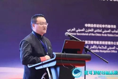
Professor Cai Yi, Chief Engineer of the National Beidou Ground-Based Augmentation System, Chief Beidou Scientist of China Ordnance Industry Group Co., Ltd., and Director of the Beidou Science and Technology Innovation Industry Alliance Expert Committee, pointed out in the keynote speech at the conference: At present, China's Beidou-3 system has achieved significant improvements in system functions, service accuracy, availability, continuity and other performance indicators, and its satellite positioning, navigation and timing capabilities are comparable to or even surpassed those of the US GPS. The Beidou augmentation system is a high-precision digitization and availability of absolute space and time. It meets the requirements of different industries for high-precision positioning, ultra-high-precision positioning, and real-time positioning, and will trigger a "location revolution."
Cai Yi said that Beigaoyao is formed by the integration of Beidou's high-precision positioning, high-resolution remote sensing images, and high-definition holographic maps. It has measurable, perceptible, and controllable characteristics. He pointed out that the full-time and space high-precision digital base jointly launched by Beigaoyuan and Chaoqing Technology is presented in the form of a holographic map. With the support of the smart hub middle layer data resource layer, it provides services for the service layer, application layer, and display layer, opening up the connection between consumption and production, realizing the integration and digitization of consumption and production, so that consumption and production, resource consumption and value creation and sharing are always in a virtuous cycle of accurate matching.
Cai Yi also focused on sharing Beigaoyao’s role in smart city construction. He mentioned that the development of Beigaoyao integrated technology will solve the current difficulties in parking, irregular parking management, and high construction costs in the city, and can reduce the cost of urban parking space management to 30% of the current cost.
Bai Weimin, vice president of Luokung Technology Company, Lu Zhe, product director, Guo Zhicheng, general manager of Inner Mongolia Langkun Technology Co., Ltd., Yan Zhiyu, general manager of Zhuhai Orbit Aerospace Technology Co., Ltd., Shuai Jianbo, CEO of Lianduo Technology (Beijing) Co., Ltd., and others gave speeches at the conference, sharing the application cases of Beidou industry in different industry scenarios such as mobile Internet, smart highways, smart transportation, smart cities, smart agriculture, remote sensing and Beidou positioning data fusion applications based on Super Engine digital base.

Finally, Zhang Quande, Secretary-General of the China Satellite Navigation and Positioning Association, made a concluding speech at the conference. Zhang Quande said that the most significant feature of the application of the Beidou system is that it is our country's independently controllable space-time benchmark. It is suitable for measuring the space-time motion status of objects. It has become a space-time benchmark for marking various types of information in the information society, and has penetrated and affected all aspects of my country's economic and social activities.
He believes that the current stage has entered a critical stage to actively promote Beidou navigation and positioning. After the completion of the Beidou-3 global network, Beidou's positioning will be better aligned with the "going global" strategy of the "One Belt, One Road" initiative. On the one hand, it can cooperate and participate in the construction of new local infrastructure, and on the other hand, it can be combined with industrial applications to go abroad, which also allows Beidou to better "go global." Truly realize "China's Beidou, the world's Beidou".
guideBeidou system is my country’s independent and controllable satelliteNavigation system, its navigation, positioning, timing and other functions help to lay a good spatio-temporal benchmark for "new infrastructure".
The successful holding of the conference also convinced us that the full-time and space-time digital base built against the background of the Beidou satellite navigation system and new infrastructure will allow system connectivity, space-time integration, and smooth services, thereby achieving more efficient organizational collaborative operations and promoting performance improvements.
This article is reprinted from "Beidou Toutiao", which supports the protection of intellectual property rights. Please indicate the original source and author when reprinting. If there is any infringement, please contact us to delete it.
Related Recommendations