






















Service Hotline
News

News

Climb to the top! Satellite transmits live footage on the way, mountaineering team uses Beidou to measure Mount Everest
2021-12-29
977
On May 27, the 2020 Everest Elevation Survey Mountaineering Team successfully climbed to the summit of Mount Everest, the world’s highest peak. They will erect a target mark on the peak, install a GNSS antenna, and carry out various peak measurements. This Mount Everest height measurement will comprehensively use a variety of traditional and modern measurement technologies. Among them, Global Navigation Satellite System (GNSS) satellite measurement is an important part, and is based on my country'sBeidou satellite navigation system dataLord. At the same time, the mountaineering team was led byChinaSat 6A communication satelliteProvide communication guarantee, and live images will be transmitted back via satellite during the process.Fengyun No. 4and other meteorological satellites to provide meteorological monitoring support.
our countryBeidou navigation satelliteMainly developed by the Fifth Academy of China Aerospace Science and Technology Corporation;ChinaSat 6A communication satelliteIt is developed by the Fifth Academy of Aerospace Science and Technology Group and operated by China Satcom, a subsidiary of Aerospace Science and Technology Group;Fengyun-4 meteorological satelliteDeveloped by the Eighth Academy of China Aerospace Science and Technology Corporation; used to launch Beidou navigation satellites, ChinaSat 6A communication satellites, and Fengyun-4 meteorological satellitesLong March 3A series launch vehicleIt is developed by the First Academy of Aerospace Science and Technology Group.
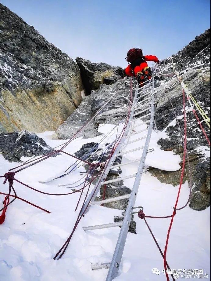
▲ Climb!
At the summit, the GNSS receiver canObtain information such as plane position, peak snow surface and earth height through satellites, and there is a certain conversion relationship between the height of the earth and the altitude.
"In 2005, GNSS satellite measurements mainly relied on the GPS system. This year, we will also refer to the four major global navigation satellite systems: American GPS, European Galileo, Russian GLONASS and Chinese Beidou, and willMainly based on Beidou data. " said Li Guopeng, captain of the First Geodetic Survey Team of the Ministry of Natural Resources.
Li Guopeng said,This is the first time the Beidou system has been used in the Mount Everest elevation measurement project.. When measuring on the summit, the GNSS receiver at the summit will rely onBeidou systemConnected with the GNSS monitoring network in the Everest region and surrounding areasmachine synchronized observation, and can also monitor thecrustal movement。
Beidou is one of the four core GNSS suppliers recognized by the United Nations International Committee on Global Satellite Navigation Systems (ICG). It began to provide global services after completing the Beidou-3 basic system at the end of 2018. In March this year,No. 54The Beidou navigation satellite has been successfully launched and entered into working orbit. It is expected that in June this year, the last networking satellite of the Beidou global system will be launched.
In this mission, from Lhasa City to the Everest Base Camp at an altitude of 5,200 meters, and then to the advance camp at an altitude of about 6,500 meters, the teamsatellitesupplyCommunication guarantee. Traveling with the surveying mountaineering teamKu-band vehicle-mounted communication system on the moveconnectChina Satcom ChinaSat 6A Satellite, signal landingChina Unicom Lhasa Satellite Center StationAfterwards, access through the dedicated lineinternet, which can provide stable network services and emergency communication support for Everest scientific expedition personnel anytime and anywhere.
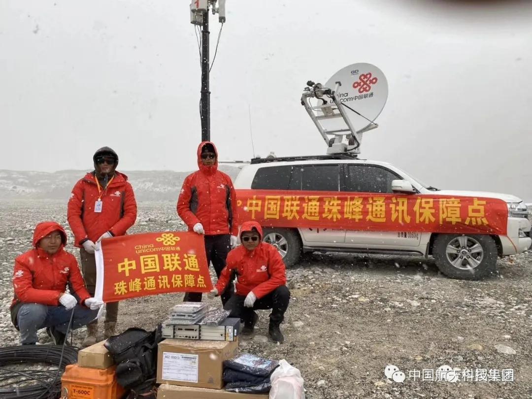
The China Satcom business personnel of Aerospace Science and Technology Group make full use of the Internet to provide users with detailed services, remotely guide users through video debugging of equipment parameters, and record short operation videos for the convenience of mountaineering teams.
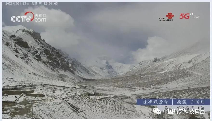
▲Screenshot of the live broadcast from the Everest Observation Deck
Considering that the extremely steep terrain and extremely complex environment of Mount Everest may pose certain challenges to the operation of communication equipment, China Satcom engineers combined their work experience to guide users to repeatedly check and confirm each link, make plans for possible difficulties and problems, allocate backup resources to users, prevent sudden interference, and make complete and optimal preparations.
This article is reprinted from "China Aerospace Science and Technology Group", which supports the protection of intellectual property rights. Please indicate the original source and author when reprinting. If there is any infringement, please contact us to delete it.
Related Recommendations