






















Service Hotline
News

News
Focus | Application and prospects of Beidou system in smart urban rail
2021-12-28
523
According to statistics, more than 80% of peopleTime is spent in non-exposed spaces such as buildings, mobile vehicles, and underground.Urban rail transit (hereinafter referred to as "urban rail"), as a typical scenario of non-exposed space, is the artery of the city and the core public area, and is also a key construction area of "new infrastructure".For a long time, positioning, navigation, timing and communication in non-exposed spaces have been global technical problems and bottlenecks restricting the development of smart urban rail.
The Beidou Satellite Navigation System (hereinafter referred to as the "Beidou System"), as a global system that provides time and space information, is an important space infrastructure independently constructed and operated by my country. The system construction has been completed and is being applied and promoted in various industries. By applying the Beidou system and building a high-precision positioning network, a high-precision time synchronization network, a high-throughput communication network and a space digital platform based on it, it can play a fundamental supporting role in the construction of smart urban rail.
Since the application of the Beidou system is fundamental, innovative, penetrating and driving, it can have a significant impact on the development form, development concept, development model and operation model of urban rail, thus promoting"Beidou + Urban Rail" new operation and management modelThe formation of the city will meet the various needs of diverse entities such as passengers, enterprises and governments, and build a smart urban rail system that is safer, more reliable, convenient and comfortable, cost-effective, green and energy-saving.
#01
Beidou System and Smart Urban Rail
①Application and development of Beidou system
At present, the Beidou system has been widely used in the fields of transportation, marine fisheries, meteorology and hydrology, power dispatching, disaster relief and mitigation, etc., and has produced significant social and economic benefits; especially in transportation, it has been widely used in vehicle positioning, transportation process monitoring and management, and infrastructure safety monitoring.
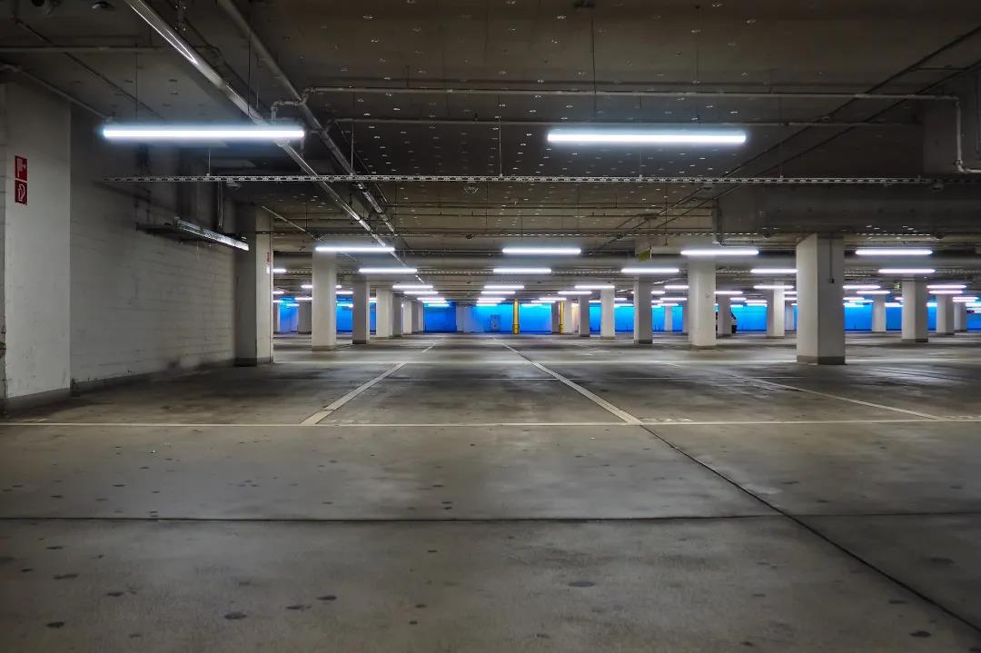
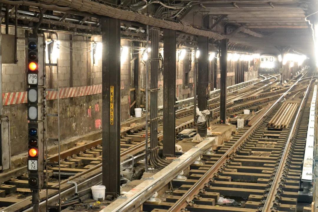
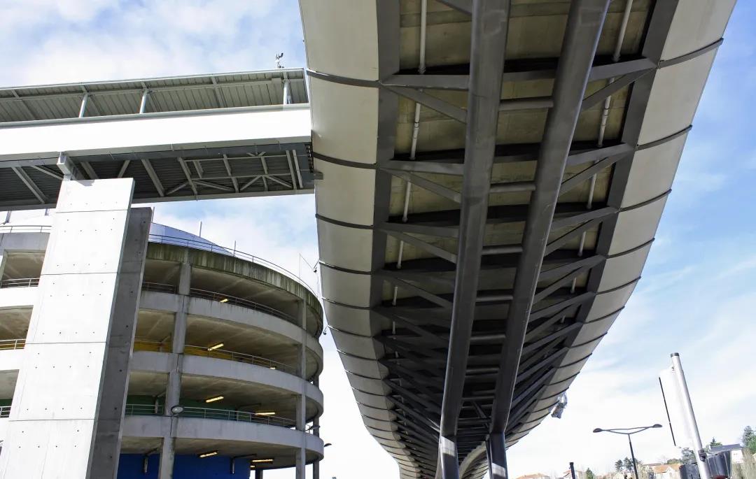
On this basis, there is room for further expansion of Beidou system applications. For example, from the perspective of the application space environment, in an outdoor exposed space environment (hereinafter referred to as "exposed space") that can directly receive satellite navigation system signals, users can directly utilize the spatiotemporal information provided by the Beidou system; however,In non-exposed space environments where satellite navigation system signals cannot be received(hereinafter referred to as "non-exposed space"), such as subways, underground parking lots, commercial complexes, and under viaducts, are affected by building obstruction and multipath effects. Satellite positioning accuracy is sharply reduced, and cannot meet the needs of non-exposed space location services.
becausePeople spend 80% of their time in non-exposed spaces such as buildings and mobile vehicles,therefore,Solving navigation and positioning problems in non-exposed space is an important direction for the application development of Beidou system。

Currently, the country is building a comprehensive positioning, navigation and timing (Positioning, Navigation and Timing, PNT) system based on the Beidou system. This system can use a variety of PNT information sources based on different principles, and through cloud platform control, high integration of multi-sensors and multi-source data fusion, generate PNT service information that has unified spatio-temporal benchmarks and has the advantages of anti-interference, anti-spoofing, robustness, usability, continuity, and reliability, achieving coverage in indoor, underwater, deep space and other fields.
②Integrated development of Beidou system and smart urban rail
In recent years, with the acceleration of construction and the continuous growth of operating mileage, urban rail has faced a series of challenges such as networked operation, cost reduction and efficiency improvement, fast service, low-carbon environmental protection, and sustainable development. This has led to the emergence of the concept of smart urban rail.
The essence of transportation is to provide displacement, that is, to realize the location movement of people and materials through transportation vehicles as needed. As a public transportation system, the core goal of the development of smart urban rail is to achieve location movement with the lowest cost and maximum coverage while ensuring safety. The method is to realize the intelligence of all links in the urban rail service process with the support of information technology, that is, "displacement +". Therefore, it is necessary to make full use of advanced information communications, artificial intelligence Intelligent, Internet of Things, big data, robotics and other technologies take autonomous perception, autonomous learning, autonomous decision-making and autonomous control as the core processing processes, and provide passengers with efficient, accurate and personalized displacement services on the basis of optimized management and control of equipment and facilities, thereby building a new generation of urban rail system that is safer, more efficient, more comfortable and greener.
Time and space location information is the basis for realizing the autonomous operation, precise management and full-time personalized services of the smart urban rail system., Therefore, the construction of smart urban rail needs to achieve integrated development with the Beidou system that provides spatio-temporal information.
The future development trend of urban rail is to promote safe, convenient, economical, efficient and green intelligent transportation in the form of "displacement+"; while the development trend of Beidou system is to empower the rail transit industry in the form of "+Beidou" (that is, using Beidou technology as an enabling means, using spatio-temporal information as an application method, combining with other industries' original technologies and original businesses or replacing traditional application solutions) to promote its transformation and upgrading. "Displacement + Beidou", as the core concept of the integrated development of the Beidou system and smart urban rail, will further enrich the technological applications and industrial ecosystems of the urban rail and Beidou systems, promote the comprehensive development of both, and thus promote the implementation of the national strategy.
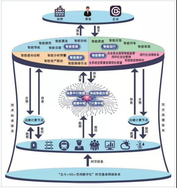
Integrated development of Beidou system and smart subway
#02
Smart urban rail’s demand for Beidou system
①Space-time benchmark
As a typical complex cyber-physical system, smart urban rail involves a wide variety of information systems such as automatic train control (ATC), automatic fare collection (AFC), power supply system management automation (SCADA), environmental monitoring (BAS), and fire alarm (FAS). In order to realize its autonomous operation, these complex information systems must be integrated to perceive, process, make decisions and control massive amounts of time and space information. Therefore, it is even more necessary to establish a unified spatio-temporal benchmark to avoid the risk of spatio-temporal information conflicts and endanger the safe operation of urban rail.By applying the Beidou system and its CGCS2000 coordinate system (the latest national geodetic coordinate system in my country) that provides positioning and navigation services, the urban rail system can obtain a unified, autonomous and controllable spatio-temporal reference.
In addition, the space environment in which urban rail is located is very complex, with exposed space and non-exposed space coexisting. Simply relying on satellite navigation systems cannot meet current application needs. By introducing the absolute spatio-temporal reference of the Beidou system into the non-exposed space of urban rail and maintaining it dynamically, on the one hand, it is possible to unify the relative position of the non-exposed space and the absolute position of the exposed space, and display and apply the position of the non-exposed space in the urban rail in the form of an absolute coordinate system; on the other hand, it is possible to unify time and achieve time synchronization in the non-exposed space.
②Space digitization
Due to the complex spatial environment of urban rail, mastering rich and accurate geographical information is the basis for the construction and operation of smart urban rail. Spatial digitization, i.e.构建数字化的地理信息空间数据框架(Digital Geospatial Data Framework,DSDF), is the product of the development and integration of surveying and mapping technology, geographic information technology and other modern information technologies.
With the advancement of technical means, surveying and mapping technology is developing in the direction of three-dimensional digitization, networking, real-time, and visualization of information collection, data processing, and application of results. There is a need for spatial digital application with three-dimensional real-life modeling as the core. In the construction of smart urban rail, it is necessary to use the spatio-temporal benchmark of the Beidou system to use station-mounted, push-broom, backpack, handheld and other surveying and mapping tools and geographical information data collection equipment to conduct computer rooms, station halls, sections, depots, and warehouses in the underground and above-ground spaces of the urban rail. In other places, we collect 3D laser point cloud data around spatial structures, equipment and facilities, consumables and other elements, and supplement it with data information such as on-site photography and textures to create a set of fine real-life 3D models with all elements to realize the spatial digitization of urban rail.
Using the above data, relevant staff can generate high-precision maps, sort out spatial resources, grasp the spatial structure and facilities and equipment of urban rail, provide accurate and comprehensive geographical information for the planning, construction, renovation and maintenance of smart urban rail, and provide important basic information and technical support for space utilization and refined management. As a new scenario application of Beidou technology in the space-time system, spatial digitization has injected new vitality into the development of smart urban rail.
③High-precision positioning and timing
High-precision spatial and time information is the basis for building smart urban rail. Traffic data is a typical spatiotemporal data, which not only has time dimension attributes, but also has a strong dependence on spatial structure.
With the integration and development of different rail transit information systems, the requirements for positioning accuracy and time synchronization accuracy continue to increase. At present, the Beidou system cannot directly meet the requirements of smart urban rail for high-precision positioning and timing. The reasons are as follows:
Difficulty receiving satellite signals.In the non-exposed space of urban rail, due to the shielding of walls (especially reinforced concrete), satellite positioning signals will be significantly weakened after passing through buildings, and the positioning accuracy will be greatly reduced, and the signal may even be unable to be received.
Multiple obstacles and interference sources.There are various types of obstacles in the urban rail, such as columns, elevators, escalators, equipment, screen doors, and pedestrians. The layouts are different. In addition, pedestrians and vehicles are moving all the time, and the signal will be reflected multiple times. These numerous uncertainties make the urban rail environment extremely complex. This situation is particularly prominent in the subway, because the subway environment is relatively closed, and complex environmental interference such as radio signals, sound, light, and temperature will have a negative impact on the accuracy of positioning equipment sensors.
Elevation positioning is difficult.In a subway environment, not only the position of the two-dimensional plane must be considered, but also the position and height of the above-ground and underground floors for multi-story buildings.
It is difficult to develop application terminals.Urban rail requires miniaturization, personalization, and combined application terminals, and solves problems such as component optimization design, material selection, precision manufacturing, deep component integration, real-time sensor calibration, and adaptive fusion of sensor output information. Researchers should start from the above four aspects and conduct targeted research to solve the above problems, so as to provide high-precision space and time information for the construction and operation of smart urban rail and ensure its smooth progress.
#03
Prospects for the application of Beidou system in smart urban rail
①Construction of space-time system network
Smart urban rail must build an autonomous and controllable space-time system network.
In view of the problems such as the inability of Beidou system navigation and positioning in non-exposed space, lack of high-throughput communication means, and lack of all-element geographical information, the "Beidou + 5G + space digitalization" technology should be comprehensively applied to build a "three networks and one platform" spatio-temporal system network composed of a high-precision positioning network, a high-precision time synchronization network, a high-throughput communication network and a space digital platform. Form an urban rail spatio-temporal reference information network and use it as the infrastructure for smart urban rail construction and operation to provide unified and continuous space and time information, as well as positioning, timing, and communication services for urban rail, thereby complementing, enhancing, and backing up Beidou system applications in non-exposed spaces, thereby breaking the barriers between urban rail exposed spaces and non-exposed spaces.
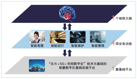
Construction of smart urban rail space-time system network
②Key technology space-time benchmarks that need to be broken through
To build a smart urban rail space-time system network, it is necessary to focus on breakthroughs in key technologies such as indoor and outdoor integrated high-precision continuous positioning, large-scale high-precision time-frequency transmission based on universal network protocols, and high-throughput wireless communication applications based on 5G.

In terms of positioning, it is necessary to use ultra-wideband (UWB) positioning technology as the dominant positioning technology on a unified spatial benchmark, supplemented and enhanced by multiple positioning technologies, and through the integration of navigation and positioning software and algorithms to achieve continuous positioning in exposed and non-exposed spaces; through the comprehensive PNT system invested and constructed by the state and the micro-PNT system developed by miniaturized, personalized, and combined service terminals, high-precision location services can be provided.
In terms of time, it is necessary to achieve dynamic time synchronization of the entire network nodes in the intercity range based on the precision clock synchronization protocol of the IEEE 1588V2 network measurement and control system (also known as the Precision Time Synchronization Protocol (PTP)), combined with Synchronous Ethernet (SyncE) technology and the White Rabbit (WR) time synchronization method, on a unified time basis to provide high-precision timing services.
In terms of communications, it is necessary to develop urban rail indoor distribution systems and time slicing algorithms for subway services to realize the application of high-throughput communications. In addition, as the system construction progresses, it is also necessary to break through a series of key technologies used by the Beidou system in smart urban rail.
③Application servicesApplication is the starting point and goal of the integrated development of Beidou system and smart urban rail. The Beidou system will give urban rail new capabilities and means in terms of intelligent operation, intelligent maintenance, and intelligent customer service, provide effective support for urban rail business, and help build a smart urban rail system with sophisticated management, efficient operation, and maximum benefits.
In terms of intelligent operation, through the Beidou system, real-time high-precision location information of station, management and construction personnel can be obtained. On this basis, urban rail workers can be accurately managed through the construction of electronic fences, electronic roll-call and sign-in, performance appraisal analysis, etc. Train positioning is the guarantee for the safe and efficient operation of urban rail trains. The use of the Beidou system can make train positioning more accurate, more redundant, more autonomous, deeper integrated, and more efficient in linkage.
In terms of intelligent maintenance, urban rail facilities and equipment are complex, highly automated, and have large asset scales. Their maintenance and management are directly related to the safety and reliability of urban rail operations. Obtaining the accurate location of facilities and equipment through the Beidou system can realize automatic inventory of assets and equipment based on precise location in the asset management system, creating a closed-loop chain of condition monitoring, fault diagnosis, risk warning, maintenance evaluation and asset management.
In terms of intelligent customer service, using the Beidou system, passengers can quickly search and plan routes for self-service ticket machines, self-service vending machines, restrooms and other service facilities inside and outside urban rail stations; they can also implement functions such as self-service navigation, intelligent mobile terminals and robot guidance services based on multi-dimensional and multi-layered digital maps, thus being able to provide passengers with full-time, personalized travel services based on passenger travel needs.
#04
Conclusion
Time and space information have become basic information in modern production and life. The development of satellite navigation and positioning systems has completely changed people's lifestyles and also changed the management models of society and enterprises. With the completion and application promotion of the Beidou system, the construction and development of my country's smart urban rail have put forward higher requirements for spatiotemporal benchmarks, spatial digitization, high-precision positioning and timing.
In the future, Beidou system and smart urban rail have broad space and potential for integration. The core is to define its PNT system based on urban rail application scenarios, break through key technologies, and build a "three networks and one platform" space-time system network. The application and promotion of the Beidou system will create optimal basic conditions for the intelligent transformation of urban rail.
References:
Lin Luzhou, Li Yujie, Deng Pingke, et al. Application and prospects of Beidou system in smart urban rail [J]. Modern Urban Rail Transit, 2021 (4):6-10.
This content comes from the Internet/Beidou Today. This website only provides reprinting. The views, stance, technology, etc. of this article have nothing to do with this website. If there is any infringement, please contact us to delete it!
Related Recommendations