























Linea diretta di assistenza
Notizie

Notizie
Focus | Applicazioni e prospettive del sistema Beidou nelle ferrovie urbane intelligenti
2021-12-28
522
Secondo le statistiche, oltre l'80% delle personeTime is spent in non-exposed spaces such as buildings, mobile vehicles, and underground.Urban rail transit (hereinafter referred to as "urban rail"), as a typical scenario of non-exposed space, is the artery of the city and the core public area, and is also a key construction area of "new infrastructure".For a long time, positioning, navigation, timing and communication in non-exposed spaces have been global technical problems and bottlenecks restricting the development of smart urban rail.
The Beidou Satellite Navigation System (hereinafter referred to as the "Beidou System"), as a global system that provides time and space information, is an important space infrastructure independently constructed and operated by my country. The system construction has been completed and is being applied and promoted in various industries. By applying the Beidou system and building a high-precision positioning network, a high-precision time synchronization network, a high-throughput communication network and a space digital platform based on it, it can play a fundamental supporting role in the construction of smart urban rail.
Since the application of the Beidou system is fundamental, innovative, penetrating and driving, it can have a significant impact on the development form, development concept, development model and operation model of urban rail, thus promoting"Beidou + Urban Rail" new operation and management modelLa realizzazione della città soddisferà le diverse esigenze di soggetti eterogenei come passeggeri, imprese e amministrazioni pubbliche, e creerà un sistema ferroviario urbano intelligente che sarà più sicuro, affidabile, comodo e confortevole, economicamente vantaggioso, ecologico e a risparmio energetico.
#01
Beidou System and Smart Urban Rail
①Application and development of Beidou system
Attualmente, il sistema Beidou è ampiamente utilizzato nei settori dei trasporti, della pesca marittima, della meteorologia e dell'idrologia, della gestione dell'energia, del soccorso e della mitigazione dei disastri, ecc., e ha prodotto significativi benefici sociali ed economici; in particolare, nel settore dei trasporti, è ampiamente utilizzato per il posizionamento dei veicoli, il monitoraggio e la gestione dei processi di trasporto e il monitoraggio della sicurezza delle infrastrutture.
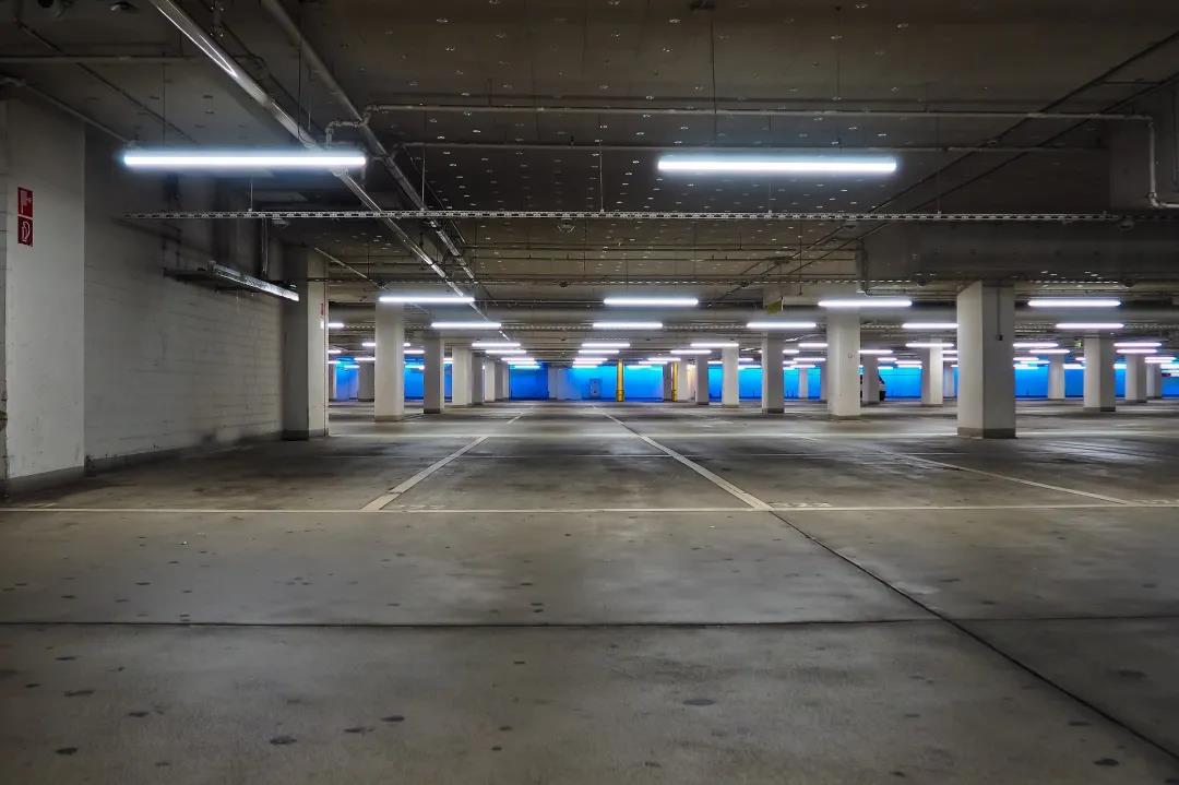
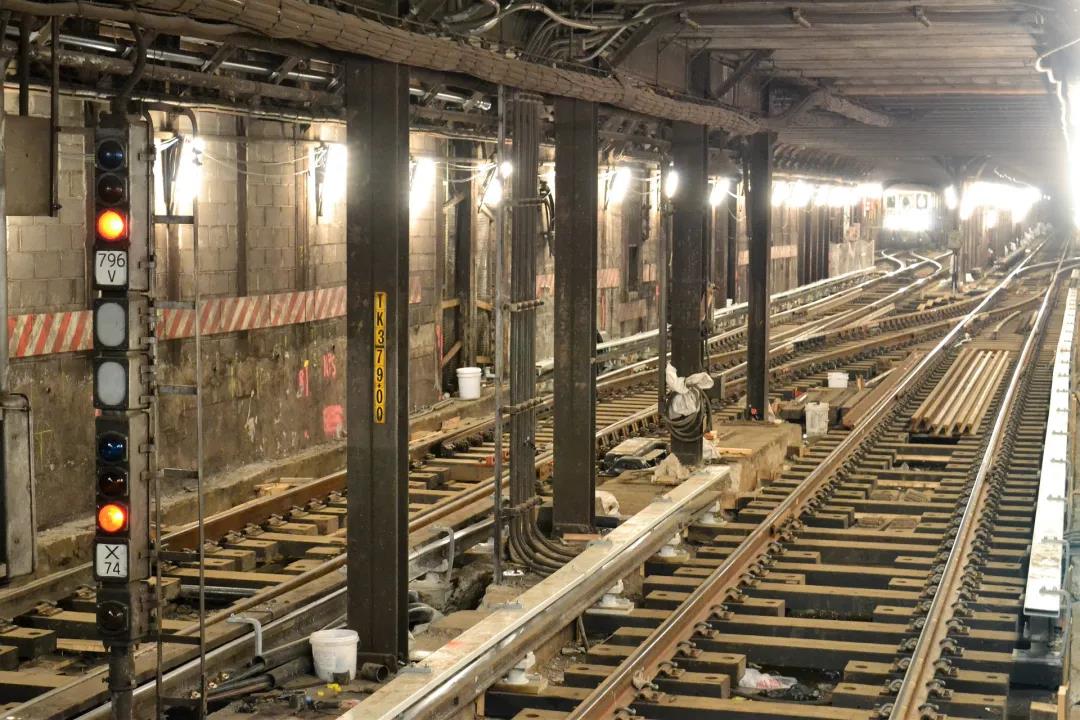
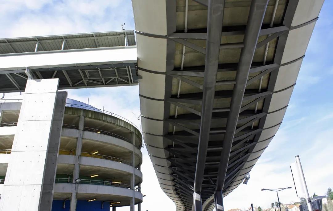
On this basis, there is room for further expansion of Beidou system applications. For example, from the perspective of the application space environment, in an outdoor exposed space environment (hereinafter referred to as "exposed space") that can directly receive satellite navigation system signals, users can directly utilize the spatiotemporal information provided by the Beidou system; however,In ambienti spaziali non esposti dove non è possibile ricevere i segnali del sistema di navigazione satellitare(di seguito denominato "spazio non esposto"), come metropolitane, parcheggi sotterranei, complessi commerciali e aree sotto i viadotti, risentono dell'ostruzione causata dagli edifici e degli effetti multipath. La precisione del posizionamento satellitare risulta drasticamente ridotta e non è in grado di soddisfare le esigenze dei servizi di localizzazione in spazi non esposti.
perchéLe persone trascorrono l'80% del loro tempo in spazi non esposti, come edifici e veicoli in movimento.,therefore,Solving navigation and positioning problems in non-exposed space is an important direction for the application development of Beidou system.

Currently, the country is building a comprehensive positioning, navigation and timing (Positioning, Navigation and Timing, PNT) system based on the Beidou system. This system can use a variety of PNT information sources based on different principles, and through cloud platform control, high integration of multi-sensors and multi-source data fusion, generate PNT service information that has unified spatio-temporal benchmarks and has the advantages of anti-interference, anti-spoofing, robustness, usability, continuity, and reliability, achieving coverage in indoor, underwater, deep space and other fields.
②Sviluppo integrato del sistema Beidou e della ferrovia urbana intelligente
Negli ultimi anni, con l'accelerazione delle costruzioni e la continua crescita del chilometraggio operativo, il trasporto ferroviario urbano si è trovato ad affrontare una serie di sfide quali la gestione in rete, la riduzione dei costi e il miglioramento dell'efficienza, la rapidità del servizio, la tutela dell'ambiente a basse emissioni di carbonio e lo sviluppo sostenibile. Ciò ha portato all'emergere del concetto di trasporto ferroviario urbano intelligente.
L'essenza del trasporto è fornire spostamento, ovvero realizzare il movimento di persone e materiali attraverso veicoli di trasporto in base alle necessità. Come sistema di trasporto pubblico, l'obiettivo principale dello sviluppo della ferrovia urbana intelligente è quello di realizzare il movimento in base alle necessità con il minor costo e la massima copertura, garantendo al contempo la sicurezza. Il metodo consiste nel realizzare l'intelligenza di tutti gli anelli del processo di servizio ferroviario urbano con il supporto delle tecnologie informatiche, ovvero "spostamento +". Pertanto, è necessario sfruttare appieno le tecnologie avanzate di comunicazione, l'intelligenza artificiale, l'Internet delle cose, i big data, la robotica e altre tecnologie, assumendo come processi di elaborazione centrali la percezione autonoma, l'apprendimento autonomo, il processo decisionale autonomo e il controllo autonomo, e fornire ai passeggeri servizi di spostamento efficienti, precisi e personalizzati sulla base di una gestione e un controllo ottimizzati di attrezzature e infrastrutture, costruendo così una nuova generazione di sistemi ferroviari urbani più sicuri, più efficienti, più comodi e più ecologici.
Time and space location information is the basis for realizing the autonomous operation, precise management and full-time personalized services of the smart urban rail system.Pertanto, la costruzione di una ferrovia urbana intelligente deve raggiungere uno sviluppo integrato con il sistema Beidou, che fornisce informazioni spazio-temporali.
The future development trend of urban rail is to promote safe, convenient, economical, efficient and green intelligent transportation in the form of "displacement+"; while the development trend of Beidou system is to empower the rail transit industry in the form of "+Beidou" (that is, using Beidou technology as an enabling means, using spatio-temporal information as an application method, combining with other industries' original technologies and original businesses or replacing traditional application solutions) to promote its transformation and upgrading. "Displacement + Beidou", as the core concept of the integrated development of the Beidou system and smart urban rail, will further enrich the technological applications and industrial ecosystems of the urban rail and Beidou systems, promote the comprehensive development of both, and thus promote the implementation of the national strategy.
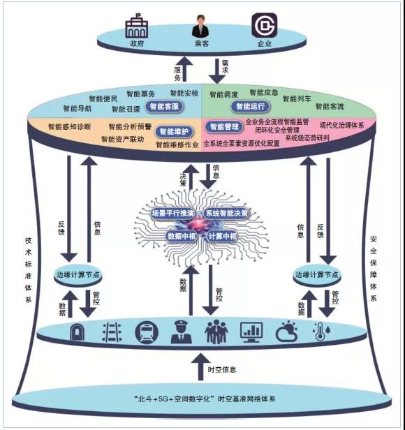
Sviluppo integrato del sistema Beidou e della metropolitana intelligente
#02
Smart urban rail’s demand for Beidou system
①Space-time benchmark
As a typical complex cyber-physical system, smart urban rail involves a wide variety of information systems such as automatic train control (ATC), automatic fare collection (AFC), power supply system management automation (SCADA), environmental monitoring (BAS), and fire alarm (FAS). In order to realize its autonomous operation, these complex information systems must be integrated to perceive, process, make decisions and control massive amounts of time and space information. Therefore, it is even more necessary to establish a unified spatio-temporal benchmark to avoid the risk of spatio-temporal information conflicts and endanger the safe operation of urban rail.Applicando il sistema Beidou e il suo sistema di coordinate CGCS2000 (il più recente sistema di coordinate geodetiche nazionale del mio paese), che fornisce servizi di posizionamento e navigazione, il sistema ferroviario urbano può ottenere un riferimento spazio-temporale unificato, autonomo e controllabile.
In addition, the space environment in which urban rail is located is very complex, with exposed space and non-exposed space coexisting. Simply relying on satellite navigation systems cannot meet current application needs. By introducing the absolute spatio-temporal reference of the Beidou system into the non-exposed space of urban rail and maintaining it dynamically, on the one hand, it is possible to unify the relative position of the non-exposed space and the absolute position of the exposed space, and display and apply the position of the non-exposed space in the urban rail in the form of an absolute coordinate system; on the other hand, it is possible to unify time and achieve time synchronization in the non-exposed space.
②Space digitization
Due to the complex spatial environment of urban rail, mastering rich and accurate geographical information is the basis for the construction and operation of smart urban rail. Spatial digitization, i.e.构建数字化的地理信息空间数据框架(Digital Geospatial Data Framework, DSDF), is the product of the development and integration of surveying and mapping technology, geographic information technology and other modern information technologies.
Con il progresso dei mezzi tecnici, la tecnologia di rilevamento e mappatura si sta sviluppando nella direzione della digitalizzazione tridimensionale, della connessione in rete, della visualizzazione in tempo reale e della raccolta di informazioni, dell'elaborazione dei dati e dell'applicazione dei risultati. Si rende quindi necessaria un'applicazione digitale spaziale con la modellazione tridimensionale del mondo reale come elemento centrale. Nella costruzione di una rete ferroviaria urbana intelligente, è necessario utilizzare il sistema di riferimento spazio-temporale Beidou per impiegare strumenti di rilevamento e mappatura montati in stazione, scope, zaini, dispositivi portatili e altre apparecchiature per la raccolta di dati geografici, al fine di realizzare sale computer, sale stazioni, sezioni, depositi e magazzini negli spazi sotterranei e in superficie della rete ferroviaria urbana. In altri contesti, si raccolgono dati di nuvole di punti laser 3D intorno a strutture spaziali, attrezzature e impianti, materiali di consumo e altri elementi, integrandoli con informazioni quali fotografie in loco e texture per creare un insieme di modelli 3D dettagliati del mondo reale, completi di tutti gli elementi, realizzando così la digitalizzazione spaziale della rete ferroviaria urbana.
Using the above data, relevant staff can generate high-precision maps, sort out spatial resources, grasp the spatial structure and facilities and equipment of urban rail, provide accurate and comprehensive geographical information for the planning, construction, renovation and maintenance of smart urban rail, and provide important basic information and technical support for space utilization and refined management. As a new scenario application of Beidou technology in the space-time system, spatial digitization has injected new vitality into the development of smart urban rail.
③High-precision positioning and timing
Informazioni spaziali e temporali ad alta precisione sono fondamentali per la realizzazione di sistemi ferroviari urbani intelligenti. I dati sul traffico sono un tipico dato spazio-temporale, che non solo possiede attributi di dimensione temporale, ma presenta anche una forte dipendenza dalla struttura spaziale.
With the integration and development of different rail transit information systems, the requirements for positioning accuracy and time synchronization accuracy continue to increase. At present, the Beidou system cannot directly meet the requirements of smart urban rail for high-precision positioning and timing. The reasons are as follows:
Difficoltà nella ricezione dei segnali satellitari.In the non-exposed space of urban rail, due to the shielding of walls (especially reinforced concrete), satellite positioning signals will be significantly weakened after passing through buildings, and the positioning accuracy will be greatly reduced, and the signal may even be unable to be received.
Multiple obstacles and interference sources.There are various types of obstacles in the urban rail, such as columns, elevators, escalators, equipment, screen doors, and pedestrians. The layouts are different. In addition, pedestrians and vehicles are moving all the time, and the signal will be reflected multiple times. These numerous uncertainties make the urban rail environment extremely complex. This situation is particularly prominent in the subway, because the subway environment is relatively closed, and complex environmental interference such as radio signals, sound, light, and temperature will have a negative impact on the accuracy of positioning equipment sensors.
Il posizionamento in elevazione è difficile.In un ambiente metropolitano, non bisogna considerare solo la posizione del piano bidimensionale, ma anche la posizione e l'altezza dei piani fuori terra e sotterranei degli edifici a più piani.
È difficile sviluppare terminali applicativi.La metropolitana urbana richiede miniaturizzazione, personalizzazione e terminali applicativi combinati, e risolve problemi quali la progettazione ottimizzata dei componenti, la selezione dei materiali, la produzione di precisione, la profonda integrazione dei componenti, la calibrazione dei sensori in tempo reale e la fusione adattiva delle informazioni di output dei sensori. I ricercatori dovrebbero partire da questi quattro aspetti e condurre ricerche mirate per risolvere i problemi sopra menzionati, in modo da fornire informazioni spazio-temporali ad alta precisione per la costruzione e la gestione della metropolitana urbana intelligente e garantirne il regolare sviluppo.
#03
Prospects for the application of Beidou system in smart urban rail
①Construction of space-time system network
Smart urban rail must build an autonomous and controllable space-time system network.
In view of the problems such as the inability of Beidou system navigation and positioning in non-exposed space, lack of high-throughput communication means, and lack of all-element geographical information, the "Beidou + 5G + space digitalization" technology should be comprehensively applied to build a "three networks and one platform" spatio-temporal system network composed of a high-precision positioning network, a high-precision time synchronization network, a high-throughput communication network and a space digital platform. Form an urban rail spatio-temporal reference information network and use it as the infrastructure for smart urban rail construction and operation to provide unified and continuous space and time information, as well as positioning, timing, and communication services for urban rail, thereby complementing, enhancing, and backing up Beidou system applications in non-exposed spaces, thereby breaking the barriers between urban rail exposed spaces and non-exposed spaces.
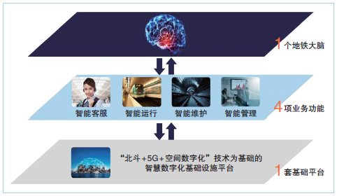
Construction of smart urban rail space-time system network
②Principali parametri di riferimento spazio-temporali tecnologici che devono essere superati
To build a smart urban rail space-time system network, it is necessary to focus on breakthroughs in key technologies such as indoor and outdoor integrated high-precision continuous positioning, large-scale high-precision time-frequency transmission based on universal network protocols, and high-throughput wireless communication applications based on 5G.

In termini di posizionamento, è necessario utilizzare la tecnologia di posizionamento a banda ultralarga (UWB) come tecnologia di posizionamento dominante su un benchmark spaziale unificato, integrato e potenziato da molteplici tecnologie di posizionamento, e attraverso l'integrazione di software e algoritmi di navigazione e posizionamento per ottenere un posizionamento continuo in spazi esposti e non esposti; attraverso il sistema PNT completo investito e costruito dallo stato e il sistema micro-PNT sviluppato da terminali di servizio miniaturizzati, personalizzati e combinati, è possibile fornire servizi di localizzazione ad alta precisione.
In terms of time, it is necessary to achieve dynamic time synchronization of the entire network nodes in the intercity range based on the precision clock synchronization protocol of the IEEE 1588V2 network measurement and control system (also known as the Precision Time Synchronization Protocol (PTP)), combined with Synchronous Ethernet (SyncE) technology and the White Rabbit (WR) time synchronization method, on a unified time basis to provide high-precision timing services.
In terms of communications, it is necessary to develop urban rail indoor distribution systems and time slicing algorithms for subway services to realize the application of high-throughput communications. In addition, as the system construction progresses, it is also necessary to break through a series of key technologies used by the Beidou system in smart urban rail.
③Application servicesApplication is the starting point and goal of the integrated development of Beidou system and smart urban rail. The Beidou system will give urban rail new capabilities and means in terms of intelligent operation, intelligent maintenance, and intelligent customer service, provide effective support for urban rail business, and help build a smart urban rail system with sophisticated management, efficient operation, and maximum benefits.
In terms of intelligent operation, through the Beidou system, real-time high-precision location information of station, management and construction personnel can be obtained. On this basis, urban rail workers can be accurately managed through the construction of electronic fences, electronic roll-call and sign-in, performance appraisal analysis, etc. Train positioning is the guarantee for the safe and efficient operation of urban rail trains. The use of the Beidou system can make train positioning more accurate, more redundant, more autonomous, deeper integrated, and more efficient in linkage.
In terms of intelligent maintenance, urban rail facilities and equipment are complex, highly automated, and have large asset scales. Their maintenance and management are directly related to the safety and reliability of urban rail operations. Obtaining the accurate location of facilities and equipment through the Beidou system can realize automatic inventory of assets and equipment based on precise location in the asset management system, creating a closed-loop chain of condition monitoring, fault diagnosis, risk warning, maintenance evaluation and asset management.
In terms of intelligent customer service, using the Beidou system, passengers can quickly search and plan routes for self-service ticket machines, self-service vending machines, restrooms and other service facilities inside and outside urban rail stations; they can also implement functions such as self-service navigation, intelligent mobile terminals and robot guidance services based on multi-dimensional and multi-layered digital maps, thus being able to provide passengers with full-time, personalized travel services based on passenger travel needs.
#04
Conclusione
Time and space information have become basic information in modern production and life. The development of satellite navigation and positioning systems has completely changed people's lifestyles and also changed the management models of society and enterprises. With the completion and application promotion of the Beidou system, the construction and development of my country's smart urban rail have put forward higher requirements for spatiotemporal benchmarks, spatial digitization, high-precision positioning and timing.
In the future, Beidou system and smart urban rail have broad space and potential for integration. The core is to define its PNT system based on urban rail application scenarios, break through key technologies, and build a "three networks and one platform" space-time system network. The application and promotion of the Beidou system will create optimal basic conditions for the intelligent transformation of urban rail.
Riferimenti:
Lin Luzhou, Li Yujie, Deng Pingke, et al. Application and prospects of Beidou system in smart urban rail [J]. Modern Urban Rail Transit, 2021 (4):6-10.
Questo contenuto proviene da Internet/Beidou Today. Questo sito web si limita a riprodurlo. Le opinioni, le posizioni, la tecnologia, ecc. di questo articolo non hanno nulla a che vedere con questo sito web. In caso di violazione del copyright, vi preghiamo di contattarci per richiederne la rimozione!
Raccomandazioni correlate